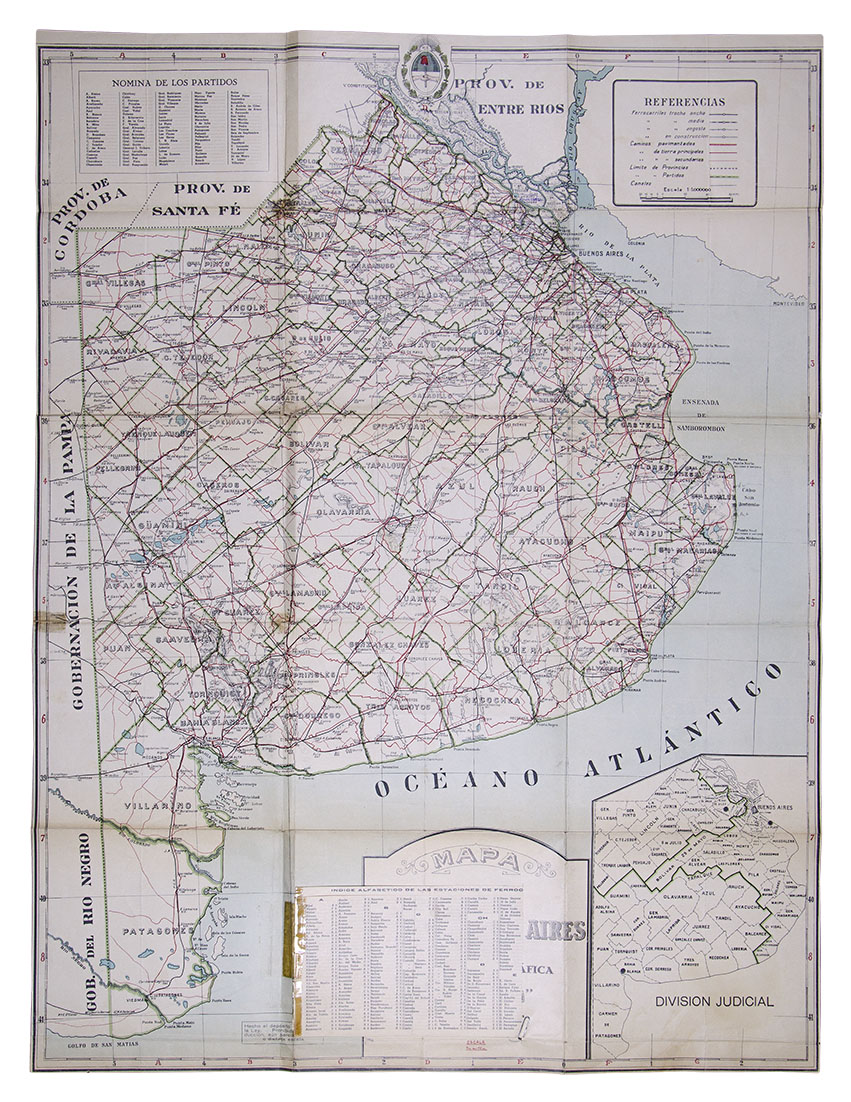
Map of the Province of Buenos Aires. Circa 1940.
Printed on heavyweight paper, folded. Measurements: 61 x 90 cm. It has added, a detail of the train stations, so many of them today disappeared before the closing of branches. Work in good condition, with small deterioration in the folds and in the gluing area of the "Alphabetical index of railway stations".
Identifies paved and dirt roads, broad, medium and narrow gauge railways, built and under construction. Jurisdictional limits and payrolls of the different Parties. Very complete plan.
Pablo Ludwig's cartographic office was one of the great houses dedicated to the edition of maps from the end of the 19th century and well into the first half of the 20th.
S.O-XIV-SM
| AUTHOR | LUDWIG, PABLO |
|---|
Are you interested in selling some works?
Send us an email briefly indicating
which works you intend to put on sale, and we will respond. click here
Subscribe to our newsletter to be updated.
Check our Newsletters